This post is so picture-heavy, I need to separate it into two. Sorry, guys.
Today was the day! We finally drove through Glacier National Park.
That park is indescribably beautiful. The colors are way too vivid for my phone to even capture, and in the morning mist it looked ethereal and just too everything to be a real place I was experiencing.
Do me a favor and page through this Google image search of the park. Just to see how bonkers this place is.
I have a few videos of GNP on my IG story and highlights. Worth the trip over there to see them since I can’t host videos here.
Tako and I were on the road by 8 a.m. this morning, and I’m really glad we were. Even at 8:30 a.m., a line of cars was turning into the West Glacier entrance in front of us.

As soon as we came out from under the bridge, I realized I’ve actually been here before! A few years ago, my friends Pat, Jenn, Cielle, Kira, and I went whitewater rafting with the Glacier Raft Company.

All of Glacier National Park is closed to dogs (due to both wildlife preservation interests and potential danger to the dogs) except the “maintained areas” (I suppose that means anything that’s a pathway, rather than a trail) and one paved path that runs from West Glacier to Apgar Village. That “trail” is only 2.5mi long, so I figured we’d hike, spend a little time hanging in the villages on either end, then drive Going-to-the-Sun.
I was a little worried about exercising Tako today. His allergies are so bad in Montana that he’s been collapsing into a coughing/sneezing fit whenever he runs for more than a few seconds.
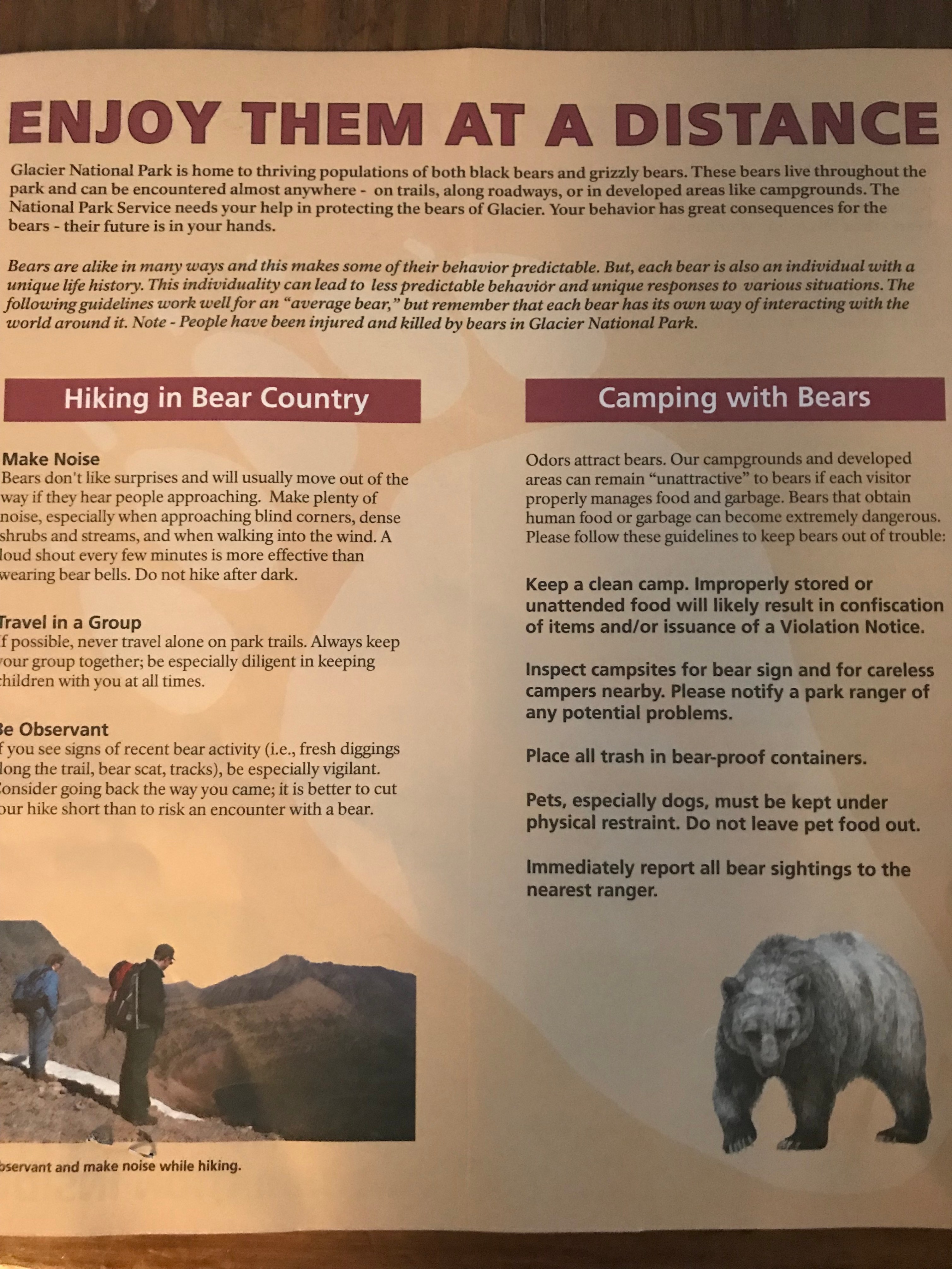
I didn’t need to worry, though. When I drove up to the kiosk (entering the park is a $35 fee), the ranger suggested I not take Tako on the only trail that allows dogs. He called Tako bear bait as he handed the map, visitor’s guide, and a conveniently topical “Be Bear Aware” pamphlet (stapled to my receipt no less) over.
So we focused our energy on driving Going-to-the-Sun Road and stopping at all the vistas.
GttSR road is the only one that runs the full-length of the park east to west, and it felt like every person in the world was on it today. That had its pros and cons.
Pro: We were moving so slowly that no one was ever in danger of sliding down the mountains. And if we had car trouble, we had a bunch of people to ask for help.

Con: By mid-day, most of the turnouts were pretty full, which meant that people were parking farther away from vistas and running on the (already super tight) road.
I was supposed to take this drive on Friday morning, but I don’t think that would have even done anything to cut down on the number of people driving it with us. It’s so popular in summer that I can’t imagine we could find a less crowded time to go.

I guess that’s like wondering if you can find a day when Big Sur is empty of cars. Dare to dream.
Weirdly enough, most of the turnouts/viewpoints along the stretch between Apgar and Red Rock Point were blocked off. There weren’t any signs explaining, so I have no idea why. I was concerned they’d be blocked for the duration of the road — precious, precious pictures!!! — but after the turnoff for Avalanche, it opened up.
The road is surprisingly short really. It only takes 3 hours to drive it because of how slowly you move through the park. So our first peek at Lake McDonald was only a few minutes into our drive.
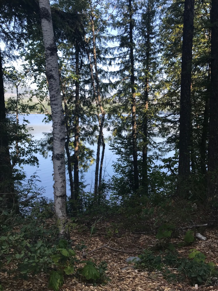
Luckily, the main parking area for McDonald was not only open but devoid of cars. Otherwise, I wouldn’t have had any privacy recovering from my mind being blown by how gorgeous that lake is.


Look at how clear and still that water is! It’s like glass.

We spent a bit of time here, just sitting and looking. From there we launched onto the main portion of the drive — though I only say that because we went from an empty turnout at McDonald to dozens of people at nearly every stop for the rest of the road.

This is going to sound strange, but I swear that the water changes color as you move through the park. Lake McDonald appears almost colorless because it’s so reflective.
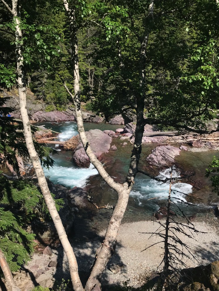
Then the river rapids turn bright blue.
And Saint Mary Lake is dark teal…

…but I couldn’t get the color quite right in my photos.
On GttSR, first you drive the flats around Lake McDonald, then you start to climb the mountainside, and that’s when the road gets a little dicier (remember the above photo?). But, again, you’re moving so slowly that even my vertigo didn’t kick in; and mine is pretty hyper-active at times.
If you ever meet her or follow her Instagram, ask Max about the time we took the Eiffel Tower elevator together. You’ll get a kick out of it, I promise.
And because of that slightly-nerve-wracking climb, around every corner is a new, jaw-dropping mountain or valley view.


And so many waterfalls!


My kryptonite.
